Region

Mount Kalaga

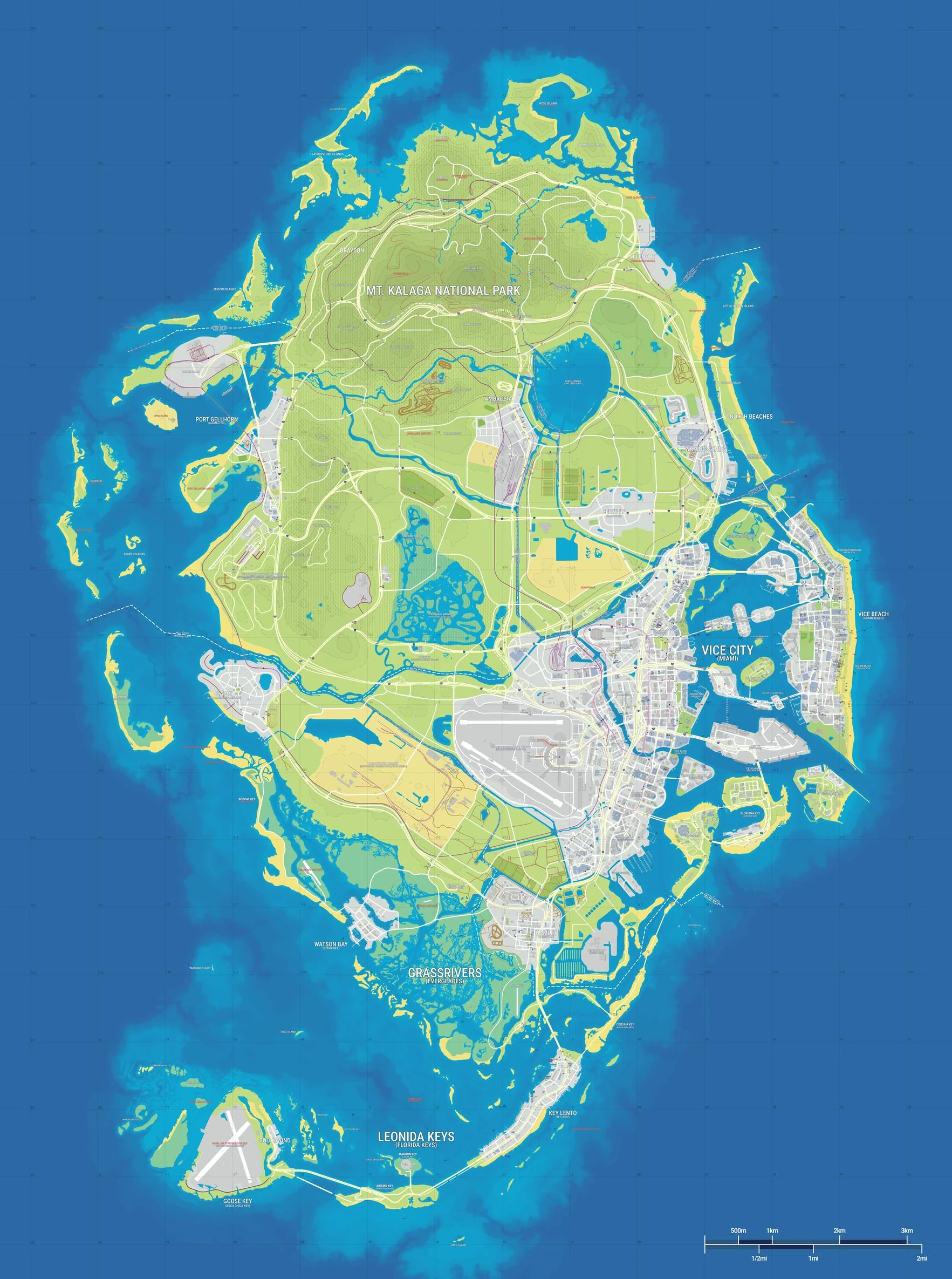
Rockstar includes Mount Kalaga — presented as Mount Kalaga National Park — among the locations introduced in Only in Leonida. It is the inland, mountainous counterpoint to Vice City’s coastline.

Find it on the map

The shaded area shows the approximate region in the community reconstruction. It represents an area rather than a specific entrance or route.

Show on interactive map ↗

Evidence and sources

Place name
Identified in Rockstar’s region and character guide. Look for “Explore Mount Kalaga” in the source.
Map position
Approximate area on the community map.

Rockstar · Only in Leonida ↗ Map evidence ↗

Exploring this type of place

Regions are areas, not single pins. Treat the shaded marker as a starting point, then sweep the roads and coastlines inside it; the place directory lists what the community has named so far.

In-game verification checklist

  • Open the in-game map and confirm the entrance or access point yourself; community pins mark approximations.
  • If the record tags a place enterable, verify the interior in person before planning a route around it.
  • Compare the pin with visible landmarks and note any drift; community positions change between dataset updates.
  • Keep a screenshot and a short note so your route list survives dataset and game updates.

What to watch for in each region

Best-mapped coast outside Vice City: the community dataset pins the bridge, bay, train station, shrimp shack and roadhouse here — a ready-made first road trip.
Map questions players ask ↗

Community map of Leonida
Yanis v18 · GTADB and contributors · CC BY 4.0

Recognize the park

Mount Kalaga National Park is the highland setting in Rockstar’s overview. Look for forested terrain and relief when comparing preview imagery. Those features distinguish the park from the low wetland landscape of Grassrivers and the dense street grid of Vice City.

Zoom from the region first

Search for Mount Kalaga or Mount Kalaga National Park and select the region marker. The map centers on an approximate park area, so use it to compare neighboring regions. A regional marker alone does not locate a trailhead, road entrance or park boundary.

Places to compare

  • Ambrosia

    Compare the inland industrial area with the park’s higher terrain.

  • Grassrivers

    A useful comparison for identifying lowland wetland footage.

Rockstar’s region and character guide ↗ · Community map sources

Nearby on the community map

Ordered by straight-line distance between the displayed map positions.

Plan your exploration

Read the Leonida map guide ↗